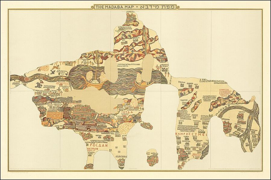
Photo: Paul Palmer, architect in Jerusalem Guthe, Friedrich Wilhelm Leopold Hermann (* 10.5.1849 Westerlinde (Braunschweig), † 11.8.1936 Leipzig) 1954 reproduction by Survey of Israel, Public domain Source

Madaba Map
I have been hereSign in to keep track of the places you have been.I want to go hereSign in to keep a list of places you want to visit. Travel advice: Be aware of safety risksParts of this country have stricter advice: Travel only if necessaryAdvice from the Dutch government. Always read the current advice before you travel.Last changed: 08-09-2026Read the current adviceThe Madaba Map, also known as the Madaba Mosaic Map, is part of a floor mosaic in the early Byzantine church of Saint George in Madaba, Jordan. The mosaic map depicts an area from Lebanon in the north to the Nile Delta in the south, and from the Mediterranean Sea in the west to the Eastern Desert. It contains the oldest surviving original cartographic depiction of the Holy Land and especially Jerusalem.
Source: Wikipedia, CC BY-SA